
Chateau de la Napoule
Built in the 14th century, this chateau has been restored and turned into an art exhibition space, visitor centre and venue for weddings and other functions.

© SeeCannes.com
A discrete path along panoramic ridges
Nestled in the alpine foothills of Grasse, this walk takes you from the coast to the top of Grosses Grues 440m. Climbing through vegetation, along rivers, over volcanic formations and past large oak trees, this walk has a lot to offer someone wanting a taste of the outdoors.
IGN maps 3543ET/3643ET are recommended for this walk.

Built in the 14th century, this chateau has been restored and turned into an art exhibition space, visitor centre and venue for weddings and other functions.

The Castre Museum is located on the Suquet hill, dominating the city of Cannes. From the top of the medieval tower the views across the bay and the Lerins islands are fantastic and not to be missed.
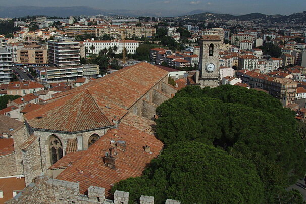
Replacing the old chapel Sainte-Anne, the Eglise Notre-Dame de l'Esperance was completed in 1627, after more than a century of work.
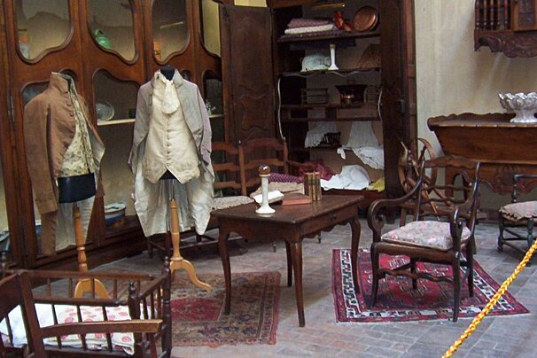
Forville Mill dates back to the 14th century. Some of the original presses are still on display, as well as traditional Provencal objects.
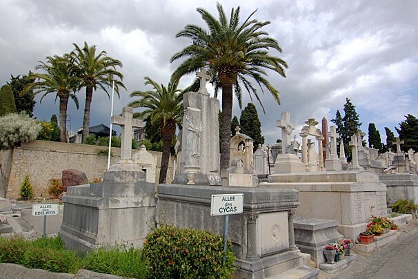
North west from the centre of Cannes is the impressive Grand Jas Cemetery. The cemetery was built in 1866 as the town centre of Cannes kept growing thus creating a need for a bigger cemetery.
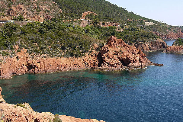
A volcanic range of mountains covering around 32,000 hectares and stretching between Saint-Raphael and Theoule-sur-Mer.

Soft white sand, a private pontoon, a lounge bar and a restaurant at the water's edge make this beach club a very special place to be.
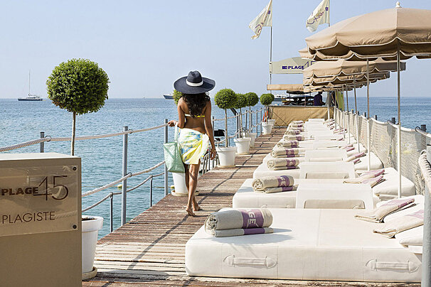
Just a short walk through the hotel garden and you can sink your feet into the soft white sand of the Grand Hotel's private beach, or enjoy a refreshing dip in the water.

L'Or Bleu, a Michelin-starred restaurant, offers an unforgettable dining experience where cuisine is elevated to the level of art. Set in an elegant, contemporary setting with breathtaking views over the bay of Théoule-sur-Mer, this Relais & Châteaux establishment is the perfect place for a memorable evening.

Le Roof at Hotel Five Seas combines refined gastronomy, breathtaking views, and a welcoming atmosphere. From gourmet breakfasts to creative lunches, the restaurant offers a range of exceptional dining experiences. The Lounge Bar is a perfect spot for cocktail lovers, offering signature drinks and a chic, trendy setting.

Le Fouquet's at the Hôtel Le Majestic combines Parisian charm with culinary excellence, led by Michelin-starred chef Pierre Gagnaire. A timeless spot for culture and cuisine lovers in Cannes.

La Plage du Martinez blends relaxed elegance with gourmet flair, offering Mediterranean dishes by Chef Jean Imbert in a stunning seafront setting.

Take a trip onboard this luxury yacht along the Riviera to any destination of your choosing.

Based in Cannes, motorbike and scooter rental so you can explore the South of France.

Take a trip onboard this luxury yacht along the Riviera to any destination of your choosing.
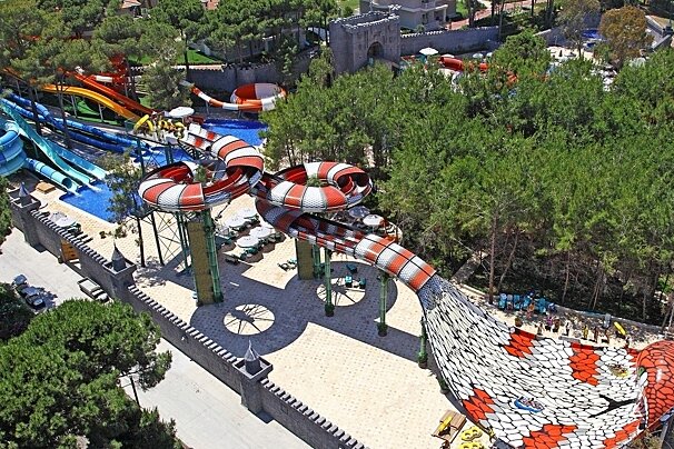
With numerous slides, including the King Cobra - unique is western Europe - this is the largest waterpark on the Cote d'Azur! Inludes a rest area, show area, clockroom, fast food, grill and pizzeria, ice creams, drinks, and shop.

This company is based in Cannes and offers a wide range of road bikes, with delivery available to Antibes.

Take a trip onboard this luxury yacht along the Riviera to any destination of your choosing.
From the tourist office on the beach front head down Avenue Charles Dahon and cross straight over the roundabout. Follow this road until its end then take the dirt road south. After a short while take the small path that leads off to the right just before the train tunnel. This path leads to Col de Theoule. From here head west, there are several short cuts that lead to Col du Trayas. From Col du Trayas take the trail west and you will soon reach Col de la Cadiere.
From Col de la Cadiere take the trail towards Grosses Grues 440m (east). This trail takes you along the ridge between the Grosses and the Petites Grues 413m. Following this trail will then take you down to Col Notre Dame 324m. At the col turn left (east), then after a short distance turn left again at the clearing, and head back north. This trail goes back along the east side of the Grues ridge then meets back up with the origional trail at Col du Trayas. Take this path back east towards the coast and the start of the walk.
Find out all about what is happening in Cannes and how to make the most of your time here. The latest news, reviews of fun activities, fabulous beaches, current events and the trendiest restaurants, as well as interviews with leading locals, insider's guides and our top choices for things to do, see and experience in this glamorous city.
See allLatest News & ReviewsYou will not be short of entertainment in this beautiful French Riviera town, especially during the summer. Perhaps the best known of all the events is the highly glamorous Cannes Film Festival – certainly worth a day trip to the city just to see which celebrities you can spot. There are also markets, international fairs and plenty of cultural and musical festivals.
See allUpcoming Events